


Boundary Voting District, Okanogan County, Washington
About
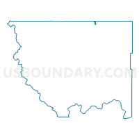
Outline

Summary
| Unique Area Identifier | 687817 |
| Name | Boundary Voting District |
| County | Okanogan County |
| State | Washington |
| Area (square miles) | 1.61 |
| Land Area (square miles) | 0.40 |
| Water Area (square miles) | 1.20 |
| % of Land Area | 25.15 |
| % of Water Area | 74.85 |
| Latitude of the Internal Point | 48.97988020 |
| Longtitude of the Internal Point | -119.45124190 |
Maps


Graphs
Select a template below for downloading or customizing gragh for Boundary Voting District, Okanogan County, Washington


Neighbors
Neighoring Voting District (by Name) Neighboring Voting District on the Map
- Eastlake Voting District, Okanogan County, WA
- Eder Voting District, Okanogan County, WA
- Shoreline Voting District, Okanogan County, WA
- Similkameen Voting District, Okanogan County, WA
- Westlake Voting District, Okanogan County, WA